Pontresina - Alp Languard - Unterer Schafberg - Muottas Muragl
Angaben zur Wanderroute
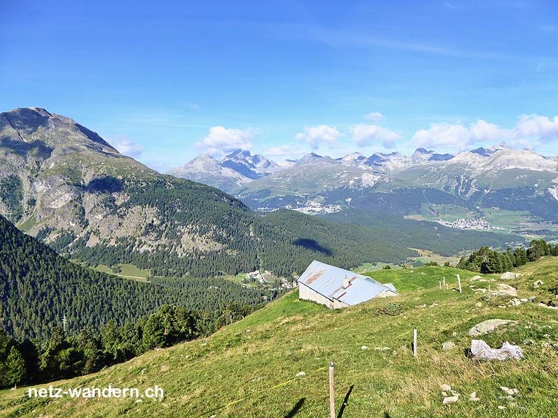
Kurzbeschreibung Route: Pontresina, Post (Bus) - Pontresina, Giarsun - Pontresina, Kirche Sta. Maria - Ers da Clüx - Alp Languard - Alp Languard, Restaurant - Laviner Giandains - Unterer Schafberg, Restaurant - Choma - Ova da Muragl - Margun - Alp Muottas - Muottas Muragl (Standseilbahn)
Kanton: Graubünden GR | Region: Oberengadin | Gemeinden: Pontresina GR, Samedan GR
- Wander- / Wegbeschreibung (PDF-Datei)
- Wanderroute (KML-Datei)
- Wanderroute (Direktimport in Swisstopo-App. Voraussetzung: App auf Smartphone / Tablet installiert)
- Karte/Route (Ansehen / Ausdrucken in SchweizMobil. Als Abonnent/-in SchweizMobil Plus Import in eigene Tourenliste möglich)
Informationen zum Wandervorschlag
Start- / Zielort
- Start: Pontresina, Post (Bus / GR)
- Ziel: Muottas Muragl (Standseilbahn / GR)
Wanderdaten
- Gehzeit: 3h20 (retour: 2h45)
- ↦ 9,6 km | ↑ 815 m | ↓ 190 m
- min. 1'821 m.ü.M. | max. 2'454 m.ü.M.
Schwierigkeitsgrad
- Technik: mittel (T2, Bergwanderweg weiss-rot-weiss)
- Kondition: mittel (Gehzeit, Hm aufwärts)
Jahreszeit
- ca. Juni bis September
Highlights
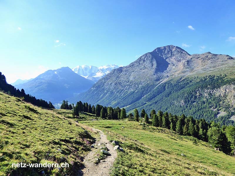
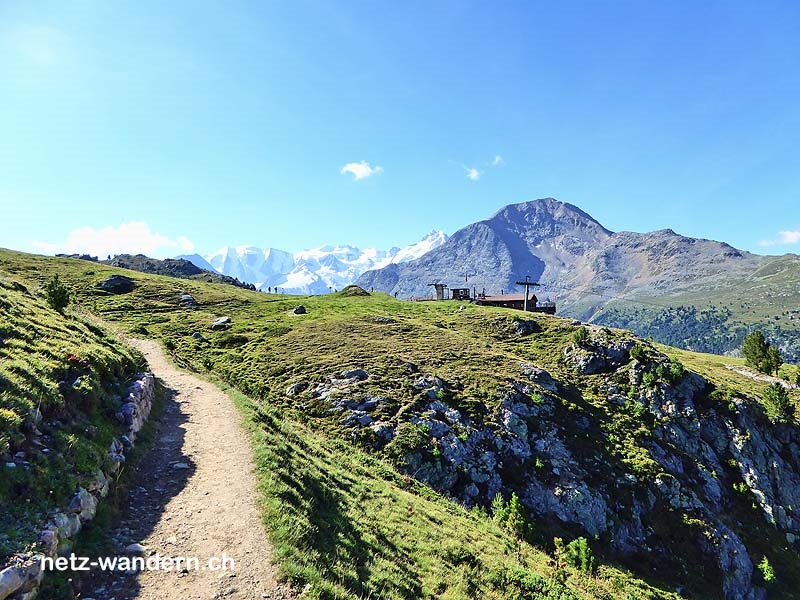
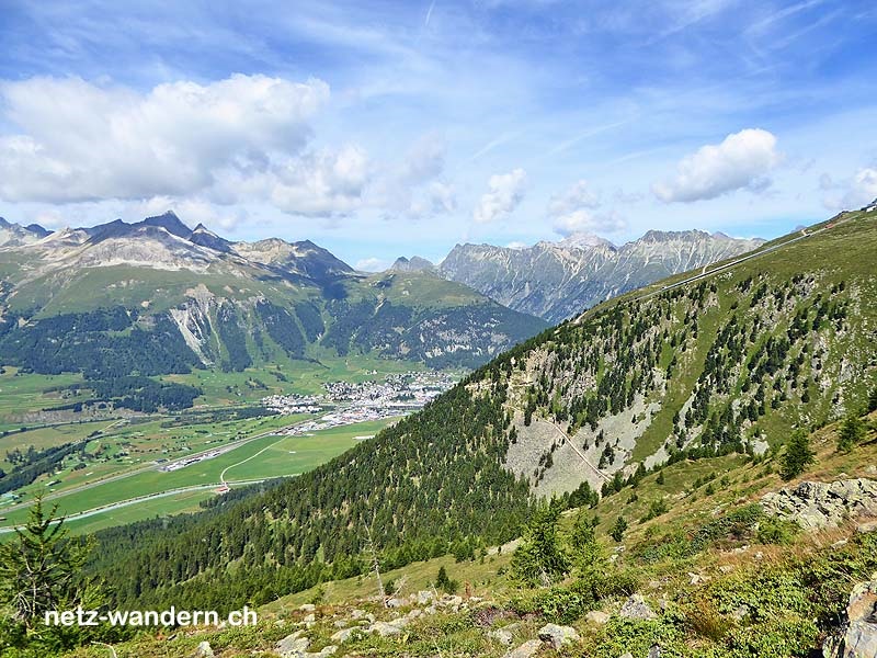
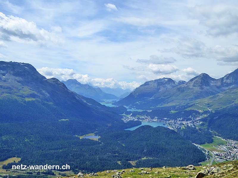
- Der Ausblick von der Alp Languard
- Der Höhen-/Panorama-Weg von der Alp Languard nach Muottas Muragl
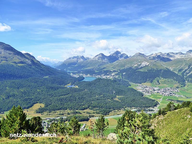
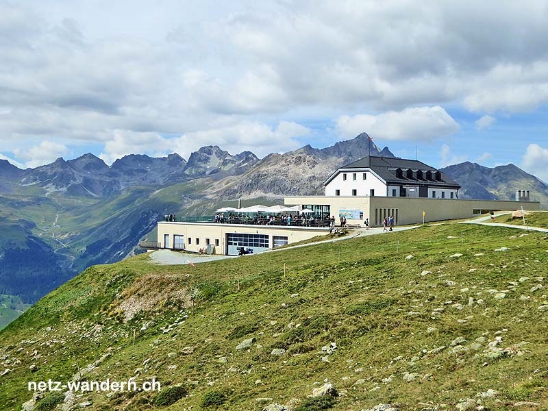
- Der Ausblick vom Hotel/Restaurant Muottas Muragl
Verpflegung / Unterkunft
- Pontresina GR: Alp Languard (Bergrestaurant, 079 719 78 10 )
- Pontresina GR: Muottas Muragl (Romantik-Hotel, Restaurant, 081 842 82 32)
- ... oder Verpflegung aus dem Rucksack
Webcams / Wetter
- Webcams: Pontresina GR (SwissWebcams)
- Wetter: Pontresina GR (SRF Meteo)
Wanderkarten
- Swisstopo Landeskarten 1:25000
Nr. 1257 St. Moritz - Swisstopo Wanderkarten 1:50000
Nr. 268T Julierpass
OeV-Haltestellen
- Pontresina, Post (Bus / Start)
- Alp Languard (Sesselbahn / Route)
- Muottas Muragl (Standseilbahn / Ziel)
Bewertung
- sehr empfehlenswert = ★★★★☆


Wandertipps in der Nähe
- Kanton: Graubünden GR
- Mikro-Region: Oberengadin
- Tourismus-Region: Graubünden
gewandert: September 2016
aktualisiert: Wanderroute - 09/2016 | übrige Infos - 01/2018
letztes Update: 23.03.2024