Rundwanderungen
Wanderungen mit gleichem Ausgangs- und Zielort.
Orte in Klammern = von/nach (...) mit Seilbahn, Standseilbahn, Zahnradbahn
Wandervorschläge
Für eine detaillierte Wanderbeschreibung einfach die gewünschte Wanderung (Infobox) anwählen.
Aargau Region
324-arisdorf-giebenach-arisdorf.html
324o1 ¦ Kantone: AG, BL ¦ mittel ¦ T1
Arisdorf - Giebenach - Arisdorf
3h20 ¦ ↦ 12,9 km ¦ ↑ 365 m ¦ ↓ 365 m 324o1 ¦ Kantone: AG, BL ¦ mittel ¦ T1
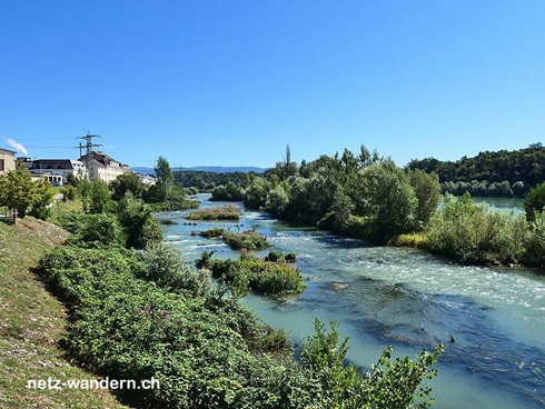
456-koblenz-doettingen-koblenz.html
456o1 ¦ Kanton: AG ¦ leicht ¦ T1
Koblenz - Döttingen - Koblenz
2h00 ¦ ↦ 8,4 km ¦ ↑ 35 m ¦ ↓ 35 m 456o1 ¦ Kanton: AG ¦ leicht ¦ T1
458-beinwil-am-see-hochwacht-beinwil-am-see.html
458o1 ¦ Kanton: AG ¦ leicht ¦ T1
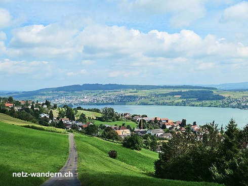
Beinwil am See - Hochwacht - Beinwil am See
2h35 ¦ ↦ 8,6 km ¦ ↑ 360 m ¦ ↓ 360 m 458o1 ¦ Kanton: AG ¦ leicht ¦ T1
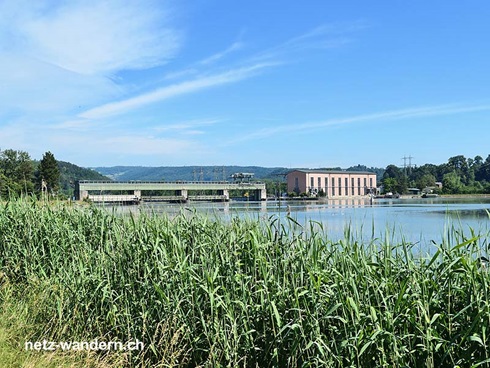
483-rheinfelden-kw-rheinfelden-rheinfelden.html
483o1 ¦ Kanton: AG ¦ leicht ¦ T1
Rheinfelden - KW Rheinfelden - Rheinfelden
1h40 ¦ ↦ 6,6 km ¦ ↑ 105 m ¦ ↓ 105 m 483o1 ¦ Kanton: AG ¦ leicht ¦ T1
Basel Region
324-arisdorf-giebenach-arisdorf.html
324o1 ¦ Kantone: AG, BL ¦ mittel ¦ T1
Arisdorf - Giebenach - Arisdorf
3h20 ¦ ↦ 12,9 km ¦ ↑ 365 m ¦ ↓ 365 m 324o1 ¦ Kantone: AG, BL ¦ mittel ¦ T1
340-reigoldswil-ulmethoechi-wasserfallen.html
340r1 ¦ Kantone: BL, SO ¦ mittel ¦ T1
Reigoldswil - Ulmethöchi - Wasserfallen - (Reigoldswil)
3h10 ¦ ↦ 9,6 km ¦ ↑ 690 m ¦ ↓ 275 m 340r1 ¦ Kantone: BL, SO ¦ mittel ¦ T1
351v1-seltisberg-schweini-seltisberg.html
351v1 ¦ Kanton: BL ¦ leicht ¦ T1
Seltisberg - Schweini - Seltisberg
2h10 ¦ ↦ 8,5 km ¦ ↑ 180 m ¦ ↓ 180 m 351v1 ¦ Kanton: BL ¦ leicht ¦ T1
354-staechpalmehegli-schleifenberg-staechpalmehegli.html
354o1 ¦ Kanton: BL ¦ leicht ¦ T1
Stächpalmehegli - Schleifenberg - Stächpalmehegli
1h50 ¦ ↦ 6,1 km ¦ ↑ 295 m ¦ ↓ 295 m 354o1 ¦ Kanton: BL ¦ leicht ¦ T1
389-wintersingerhoechi-wintersingen-wintersingerhoechi.html
389r1 ¦ Kanton: BL ¦ leicht ¦ T1
Wintersingerhöchi - Wintersingen - Wintersingerhöchi
2h40 ¦ ↦ 8,5 km ¦ ↑ 420 m ¦ ↓ 420 m 389r1 ¦ Kanton: BL ¦ leicht ¦ T1
439-eptingen-unter-chall-eptingen.html
439o1 ¦ Kanton: BL ¦ leicht ¦ T1
Eptingen - Unter Chall - Eptingen
2h20 ¦ ↦ 7,4 km ¦ ↑ 365 m ¦ ↓ 365 m 439o1 ¦ Kanton: BL ¦ leicht ¦ T1
441-sommerau-ruenenberg-sommerau.html
441o1 ¦ Kanton: BL ¦ leicht ¦ T1
Sommerau - Rünenberg - Sommerau
2h05 ¦ ↦ 7,8 km ¦ ↑ 210 m ¦ ↓ 210 m 441o1 ¦ Kanton: BL ¦ leicht ¦ T1
451-aesch-burgruine-pfeffingen-aesch.html
451o1 ¦ Kanton: BL ¦ leicht ¦ T1
Aesch BL - Burgruine Pfeffingen - Aesch BL
2h50 ¦ ↦ 9,7 km ¦ ↑ 375 m ¦ ↓ 375 m 451o1 ¦ Kanton: BL ¦ leicht ¦ T1
455-buuseregg-ruine-farnsburg-buuseregg.html
455o1 ¦ Kanton: BL ¦ leicht ¦ T1
Buuseregg - Ruine Farnsburg - Buuseregg
1h30 ¦ ↦ 5,0 km ¦ ↑ 240 m ¦ ↓ 240 m 455o1 ¦ Kanton: BL ¦ leicht ¦ T1
460-wasserfallen-vogelberg-wasserfallen.html
460o1 ¦ Kantone: BL, SO ¦ mittel ¦ T1
Wasserfallen - Vogelberg - Wasserfallen
3h05 ¦ ↦ 9,7 km ¦ ↑ 545 m ¦ ↓ 545 m 460o1 ¦ Kantone: BL, SO ¦ mittel ¦ T1
475-bubendorf-wildenstein-bubendorf.html
475o1 ¦ Kanton: BL ¦ leicht ¦ T1
Bubendorf - Wildenstein - Bubendorf
1h55 ¦ ↦ 6,8 km ¦ ↑ 230 m ¦ ↓ 230 m 475o1 ¦ Kanton: BL ¦ leicht ¦ T1
476-sissach-zunzgerhard-sissach.html
476o1 ¦ Kanton: BL ¦ leicht ¦ T1
Sissach - Zunzgerhard - Sissach
2h30 ¦ ↦ 9,1 km ¦ ↑ 305 m ¦ ↓ 305 m 476o1 ¦ Kanton: BL ¦ leicht ¦ T1
Bern Region
226-kandersteg-oeschinensee-kandersteg.html
226r1 ¦ Kanton: BE ¦ mittel ¦ T1-T2

Kandersteg - Oeschinensee - Kandersteg
3h25 ¦ ↦ 10,2 km ¦ ↑ 575 m ¦ ↓ 575 m 226r1 ¦ Kanton: BE ¦ mittel ¦ T1-T2
239-lauenen-lauenensee-lauenen.html
239o1 ¦ Kanton: BE ¦ leicht ¦ T2
Lauenen - Vorsass - Lauenensee - Lauenen
2h50 ¦ ↦ 10,2 km ¦ ↑ 355 m ¦ ↓ 355 m 239o1 ¦ Kanton: BE ¦ leicht ¦ T2
256-kleine-scheidegg-maennlichen-grindelwald.html
256o1 ¦ Kanton: BE ¦ mittel ¦ T2

(Grindelwald -) Kleine Scheidegg - Männlichen - Grindelwald
4h10 ¦ ↦ 13,8 km ¦ ↑ 310 m ¦ ↓ 1'335 m 256o1 ¦ Kanton: BE ¦ mittel ¦ T2
278-lauenen-lauenensee-lauenen.html
278o1 ¦ Kanton: BE ¦ leicht ¦ T1-T2
Lauenen - Rohröy - Lauenensee - Lauenen
2h25 ¦ ↦ 9,0 km ¦ ↑ 225 m ¦ ↓ 225 m 278o1 ¦ Kanton: BE ¦ leicht ¦ T1-T2
433o1-aeschi-hondrich-aeschi.html
433o1 ¦ Kanton: BE ¦ leicht ¦ T1
Aeschi bei Spiez - Hondrich - Aeschi bei Spiez
1h20 ¦ ↦ 5,1 km ¦ ↑ 130 m ¦ ↓ 130 m 433o1 ¦ Kanton: BE ¦ leicht ¦ T1
446-aarwangen-schwendi-aarwangen.html
446r1 ¦ Kanton: BE ¦ leicht ¦ T1
Aarwangen - Schwendi - Aarwangen
2h55 ¦ ↦ 11,6 km ¦ ↑ 180 m ¦ ↓ 180 m 446r1 ¦ Kanton: BE ¦ leicht ¦ T1
447-sunnbueel-arvenseeli-sunnbueel.html
447o1 ¦ Kanton: BE ¦ leicht ¦ T1
Sunnbüel - Arvenseeli - Sunnbüel
1h30 ¦ ↦ 5,5 km ¦ ↑ 155 m ¦ ↓ 155 m 447o1 ¦ Kanton: BE ¦ leicht ¦ T1
448-elsigenalp-elsigseeli-elsigenalp.html
448o1 ¦ Kanton: BE ¦ leicht ¦ T1
Elsigenalp - Elsigseeli - Elsigenalp
1h10 ¦ ↦ 4,2 km ¦ ↑ 170 m ¦ ↓ 170 m 448o1 ¦ Kanton: BE ¦ leicht ¦ T1
449-kandersteg-bueelbad-kandersteg.html
449o1 ¦ Kanton: BE ¦ leicht ¦ T1
Kandersteg - Büelbad - Kandersteg
0h50 ¦ ↦ 3,4 km ¦ ↑ 40 m ¦ ↓ 40 m 449o1 ¦ Kanton: BE ¦ leicht ¦ T1
Freiburg Region
332-corbieres-broc-fabrique-corbieres.html
332o1 ¦ Kanton: FR ¦ mittel ¦ T1
Corbières - Broc Fabrique - Corbières
4h00 ¦ ↦ 13,4 km ¦ ↑ 520 m ¦ ↓ 520 m 332o1 ¦ Kanton: FR ¦ mittel ¦ T1
369-schwarzsee-seeweid-schwarzsee.html
369o1 ¦ Kanton: FR ¦ leicht ¦ T1
Schwarzsee - Seeweid - Schwarzsee
1h00 ¦ ↦ 4,2 km ¦ ↑ 50 m ¦ ↓ 50 m 369o1 ¦ Kanton: FR ¦ leicht ¦ T1
Genf
Derzeit keine Rundwanderungen von dieser Tourismus-Region verfügbar.
Genferseegebiet (Waadtland)
Derzeit keine Rundwanderungen von dieser Tourismus-Region verfügbar.Graubünden
019-furtschellas-val-fex-sils-im-engadin.html
019r1 ¦ Kanton: GR ¦ leicht ¦ T2

Furtschellas - Val Fex - Sils im Engadin
2h55 ¦ ↦ 9,6 km ¦ ↑ 265 m ¦ ↓ 775 m 019r1 ¦ Kanton: GR ¦ leicht ¦ T2
020-morteratsch-gletscher-morteratsch.html
020r2 ¦ Kanton: GR ¦ leicht ¦ T2

Morteratsch - Gletscher - Morteratsch
1h35 ¦ ↦ 6,1 km ¦ ↑ 150 m ¦ ↓ 150 m 020r2 ¦ Kanton: GR ¦ leicht ¦ T2
021-sils-im-engadin-maloja-sils-im-engadin.html
021r1 ¦ Kanton: GR ¦ mittel ¦ T2

Sils im Engadin - Maloja - Sils im Engadin
4h20 ¦ ↦ 15,5 km ¦ ↑ 510 m ¦ ↓ 510 m 021r1 ¦ Kanton: GR ¦ mittel ¦ T2
022-st-moritz-punt-da-piz-st-moritz.html
022o2 ¦ Kanton: GR ¦ leicht ¦ T1-T2

St. Moritz - Punt da Piz - St. Moritz
1h05 ¦ ↦ 4,4 km ¦ ↑ 30 m ¦ ↓ 30 m 022o2 ¦ Kanton: GR ¦ leicht ¦ T1-T2
202-klosters-gotschnaboden-gotschnagrat.html
202o1 ¦ Kanton: GR ¦ schwer ¦ T2
Klosters - Gotschnaboden - Gotschnagrat (- Klosters)
3h50 ¦ ↦ 9,3 km ¦ ↑ 1'155 m ¦ ↓ 60 m 202o1 ¦ Kanton: GR ¦ schwer ¦ T2
344-pontresina-lej-da-staz-pontresina.html
344o1 ¦ Kanton: GR ¦ leicht ¦ T1
Pontresina - Lej da Staz - Pontresina
2h25 ¦ ↦ 9,0 km ¦ ↑ 255 m ¦ ↓ 255 m 344o1 ¦ Kanton: GR ¦ leicht ¦ T1
347-surlej-lej-da-champfer-surlej.html
347o1 ¦ Kanton: GR ¦ leicht ¦ T1
Surlej - Lej da Champfèr - Surlej
1h05 ¦ ↦ 4,3 km ¦ ↑ 45 m ¦ ↓ 45 m 347o1 ¦ Kanton: GR ¦ leicht ¦ T1
348-furtschellas-ils-lejins-furtschellas.html
348r1 ¦ Kanton: GR ¦ mittel ¦ T2
Furtschellas - Ils Lejins (6) - Furtschellas
2h10 ¦ ↦ 6,0 km ¦ ↑ 410 m ¦ ↓ 410 m 348r1 ¦ Kanton: GR ¦ mittel ¦ T2
383-st-moritz-champfer-st-moritz.html
383o1 ¦ Kanton: GR ¦ leicht ¦ T1
St. Moritz - Champfèr - St. Moritz
1h30 ¦ ↦ 6,0 km ¦ ↑ 50 m ¦ ↓ 410 m 383o1 ¦ Kanton: GR ¦ leicht ¦ T1
384-maloja-laegh-da-cavloc-maloja.html
384o1 ¦ Kanton: GR ¦ leicht ¦ T1
Maloja - Lägh da Cavloc - Maloja
2h10 ¦ ↦ 7,1 km ¦ ↑ 335 m ¦ ↓ 335 m 384o1 ¦ Kanton: GR ¦ leicht ¦ T1
386-pontresina-roseg-pontresina.html
386o1 ¦ Kanton: GR ¦ mittel ¦ T1-T2
Pontresina - Roseg - Pontresina
3h50 ¦ ↦ 15,0 km ¦ ↑ 360 m ¦ ↓ 360 m 386o1 ¦ Kanton: GR ¦ mittel ¦ T1-T2
414-laax-conn-laax.html
414o1 ¦ Kanton: GR ¦ leicht ¦ T1
Laax - Conn - Laax
2h35 ¦ ↦ 9,9 km ¦ ↑ 295 m ¦ ↓ 295 m 414o1 ¦ Kanton: GR ¦ leicht ¦ T1
415-laax-salums-laax.html
415o1 ¦ Kanton: GR ¦ leicht ¦ T1
Laax - Salums - Laax
1h35 ¦ ↦ 5,9 km ¦ ↑ 200 m ¦ ↓ 200 m 415o1 ¦ Kanton: GR ¦ leicht ¦ T1
434-scuol-pradella-scuol.html
434o1 ¦ Kanton: GR ¦ leicht ¦ T1
Scuol - Pradella - Scuol
1h55 ¦ ↦ 7,3 km ¦ ↑ 215 m ¦ ↓ 215 m 434o1 ¦ Kanton: GR ¦ leicht ¦ T1
436-ravaisch-samnaun-dorf-ravaisch.html
436o1 ¦ Kanton: GR ¦ leicht ¦ T1
Ravaisch - Samnaun Dorf - Ravaisch
1h05 ¦ ↦ 4,2 km ¦ ↑ 130 m ¦ ↓ 130 m 436o1 ¦ Kanton: GR ¦ leicht ¦ T1
437-tarasp-lai-nair-tarasp.html
437o1 ¦ Kanton: GR ¦ leicht ¦ T1-T2
Tarasp - Lai Nair - Tarasp
1h50 ¦ ↦ 6,2 km ¦ ↑ 260 m ¦ ↓ 260 m 437o1 ¦ Kanton: GR ¦ leicht ¦ T1-T2
457-davos-davosersee-davos.html
457o1 ¦ Kanton: GR ¦ leicht ¦ T1
Davos - Davosersee - Davos
1h25 ¦ ↦ 5,9 km ¦ ↑ 75 m ¦ ↓ 75 m 457o1 ¦ Kanton: GR ¦ leicht ¦ T1
Jura & Drei-Seen-Land
443-st-ursanne-ravines-st-ursanne.html
443o1 ¦ Kanton: JU ¦ leicht ¦ T1
St-Ursanne - Ravines - St-Ursanne
1h55 ¦ ↦ 6,5 km ¦ ↑ 280 m ¦ ↓ 280 m 443o1 ¦ Kanton: JU ¦ leicht ¦ T1
444-le-landeron-cressier-le-landeron.html
444o1 ¦ Kanton: NE ¦ leicht ¦ T1
Le Landeron - Cressier - Le Landeron
2h05 ¦ ↦ 8,2 km ¦ ↑ 150 m ¦ ↓ 150 m 444o1 ¦ Kanton: NE ¦ leicht ¦ T1
461-bassecourt-boecourt-bassecourt.html
461o1 ¦ Kanton: JU ¦ leicht ¦ T1
Bassecourt - Boécourt - Bassecourt
2h40 ¦ ↦ 10,8 km ¦ ↑ 155 m ¦ ↓ 155 m 461o1 ¦ Kanton: JU ¦ leicht ¦ T1
479-weissenstein-balmberg-weissenstein.html
479o1 ¦ Kanton: SO ¦ leicht ¦ T1
Weissenstein - Balmberg - Weissenstein
2h35 ¦ ↦ 8,2 km ¦ ↑ 420 m ¦ ↓ 420 m 479o1 ¦ Kanton: SO ¦ leicht ¦ T1
Luzern - Vierwaldstättersee
071-lungern-kaiserstuhl-lungern.html
071r1 ¦ Kanton: OW ¦ leicht ¦ T1
Lungern - Kaiserstuhl OW - Lungern
2h50 ¦ ↦ 11,2 km ¦ ↑ 245 m ¦ ↓ 245 m 071r1 ¦ Kanton: OW ¦ leicht ¦ T1
123-goescheneralp-dammareuss-goescheneralp.html
123o1 ¦ Kanton: UR ¦ mittel ¦ T2
Göscheneralp - Dammareuss - Göscheneralp
2h30 ¦ ↦ 8,3 km ¦ ↑ 505 m ¦ ↓ 505 m 123o1 ¦ Kanton: UR ¦ mittel ¦ T2
341-innerthal-au-innerthal.html
341o1 ¦ Kanton: SZ ¦ mittel ¦ T1
Innerthal - Au - Innerthal
3h15 ¦ ↦ 12,9 km ¦ ↑ 185 m ¦ ↓ 185 m 341o1 ¦ Kanton: SZ ¦ mittel ¦ T1
396-ebikon-rotsee-ebikon.html
396r1 ¦ Kanton: LU ¦ leicht ¦ T1
Ebikon - Rotsee - Ebikon
2h10 ¦ ↦ 8,8 km ¦ ↑ 105 m ¦ ↓ 105 m 396r1 ¦ Kanton: LU ¦ leicht ¦ T1
Ostschweiz
368-wasserauen-seealpsee-wasserauen.html
368o1 ¦ Kanton: AI ¦ leicht ¦ T1-T2
Wasserauen - Seealpsee - Wasserauen
2h30 ¦ ↦ 7,7 km ¦ ↑ 375 m ¦ ↓ 375 m 368o1 ¦ Kanton: AI ¦ leicht ¦ T1-T2
Tessin
Derzeit keine Rundwanderungen von dieser Tourismus-Region verfügbar.
Wallis
195-zermatt-riffelalp-gornergrat.html
195r1 ¦ Kanton: VS ¦ schwer ¦ T1-T2
Zermatt - Riffelalp - Gornergrat (- Zermatt)
4h45 ¦ ↦ 10,4 km ¦ ↑ 1'530 m ¦ ↓ 50 m 195r1 ¦ Kanton: VS ¦ schwer ¦ T1-T2
208-zermatt-zmutt-schwarzsee.html
208o1 ¦ Kanton: VS ¦ schwer ¦ T1-T2
Zermatt - Zmutt - Schwarzsee (- Zermatt)
3h40 ¦ ↦ 9,8 km ¦ ↑ 1'055 m ¦ ↓ 75 m 208o1 ¦ Kanton: VS ¦ schwer ¦ T1-T2
Zürich Region
328-pfaeffikon-seeriet-pfaeffikon.html
328o1 ¦ Kanton: ZH ¦ leicht ¦ T1
Pfäffikon - Seeriet - Pfäffikon
2h25 ¦ ↦ 10,0 km ¦ ↑ 75 m ¦ ↓ 75 m 328o1 ¦ Kanton: ZH ¦ leicht ¦ T1
364-flughafen-oberglatt-flughafen.html
364o1 ¦ Kanton: ZH ¦ mittel ¦ T1
Flughafen ZH - Oberglatt - Flughafen ZH
4h10 ¦ ↦ 17,2 km ¦ ↑ 115 m ¦ ↓ 115 m 364o1 ¦ Kanton: ZH ¦ mittel ¦ T1
471-zh_burgwies-witikon-zh_burgwies.html
471o1 ¦ Kanton: ZH ¦ leicht ¦ T1
Zürich - Witikon - Zürich
1h55 ¦ ↦ 7,1 km ¦ ↑ 220 m ¦ ↓ 220 m 471o1 ¦ Kanton: ZH ¦ leicht ¦ T1
letztes Update: 15.03.2024