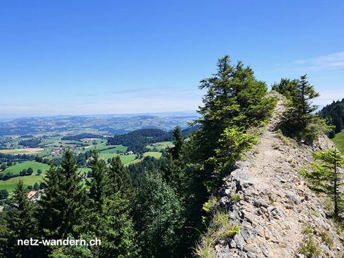
Wandern in der Region Freiburg
Auf der Suche nach Wandertipps in der Tourismus-Region Freiburg? Dann bist du hier richtig, um die vorhandenen Wandervorschläge von dieser Region anzusehen.
Diese Tourismus-Region umfasst: Kanton Freiburg
Wandervorschläge
Für eine detaillierte Wanderbeschreibung einfach die gewünschte Wanderung (Infobox) anwählen.
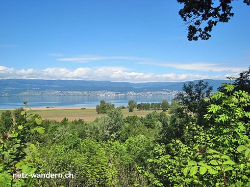
083-yverdon-les-bains-yvonand-estavayer-le-lac.html
083r1 ¦ Kantone: FR, VD ¦ schwer ¦ T1

Yverdon-les-Bains - Yvonand - Estavayer-le-Lac
5h20 ¦ ↦ 21,6 km ¦ ↑ 215 m ¦ ↓ 190 m 083r1 ¦ Kantone: FR, VD ¦ schwer ¦ T1
109-estavayer-le-lac-chevroux-portalban.html
109r1 ¦ Kantone: FR, VD ¦ mittel ¦ T1
Estavayer-le-Lac - Chevroux - Portalban
3h25 ¦ ↦ 14,0 km ¦ ↑ 70 m ¦ ↓ 105 m 109r1 ¦ Kantone: FR, VD ¦ mittel ¦ T1
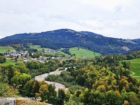
164-zweisimmen-jaunpass-jaun.html
164r1 ¦ Kanton: BE, FR ¦ schwer ¦ T1-T2
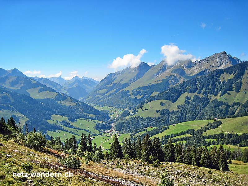
Zweisimmen - Jaunpass - Jaun
6h00 ¦ ↦ 17,4 km ¦ ↑ 1'105 m ¦ ↓ 1'025 m 164r1 ¦ Kanton: BE, FR ¦ schwer ¦ T1-T2
191-portalban-la-sauge-zihlbruecke.html
191o1 ¦ Kantone: BE, FR, NE, VD ¦ schwer ¦ T1
Portalban - La Sauge - Zihlbrücke
6h20 ¦ ↦ 26,0 km ¦ ↑ 205 m ¦ ↓ 200 m 191o1 ¦ Kantone: BE, FR, NE, VD ¦ schwer ¦ T1
205-rossiniere-lessoc-gruyeres.html
205r1 ¦ Kantone: FR, VD ¦ schwer ¦ T1
Rossinière - Lessoc - Gruyères
6h15 ¦ ↦ 23,3 km ¦ ↑ 600 m ¦ ↓ 745 m 205r1 ¦ Kantone: FR, VD ¦ schwer ¦ T1
229-ins-murten-avenches.html
229o1 ¦ Kantone: BE, FR, VD ¦ schwer ¦ T1
Ins - Murten - Avenches
5h20 ¦ ↦ 22,2 km ¦ ↑ 115 m ¦ ↓ 115 m 229o1 ¦ Kantone: BE, FR, VD ¦ schwer ¦ T1
230-schwarzenburg-st-antoni-fribourg.html
230o1 ¦ Kantone: BE, FR ¦ schwer ¦ T1
Schwarzenburg - St. Antoni - Fribourg
5h15 ¦ ↦ 20,4 km ¦ ↑ 405 m ¦ ↓ 570 m 230o1 ¦ Kantone: BE, FR ¦ schwer ¦ T1
232-avenches-vallamand-sugiez.html
232o1 ¦ Kantone: FR, VD ¦ mittel ¦ T1

Avenches - Vallamand - Sugiez
4h45 ¦ ↦ 19,0 km ¦ ↑ 310 m ¦ ↓ 315 m 232o1 ¦ Kantone: FR, VD ¦ mittel ¦ T1
253-vevey-bendes-chatel-st-denis.html
253o1 ¦ Kantone: FR, VD ¦ mittel ¦ T1
Vevey - Bendes - Châtel-St-Denis
3h30 ¦ ↦ 10,8 km ¦ ↑ 690 m ¦ ↓ 265 m 253o1 ¦ Kantone: FR, VD ¦ mittel ¦ T1
292-estavayer-le-lac-vesin-payerne.html
292o1 ¦ Kantone: FR, VD ¦ mittel ¦ T1
Estavayer-le-Lac - Vesin - Payerne
3h55 ¦ ↦ 15,3 km ¦ ↑ 335 m ¦ ↓ 345 m 292o1 ¦ Kantone: FR, VD ¦ mittel ¦ T1
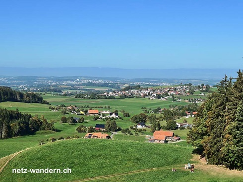
297-jaun-im-fang-charmey.html
297o1 ¦ Kanton: FR ¦ leicht ¦ T1

Jaun - Im Fang - Charmey
2h55 ¦ ↦ 11,9 km ¦ ↑ 125 m ¦ ↓ 265 m 297o1 ¦ Kanton: FR ¦ leicht ¦ T1
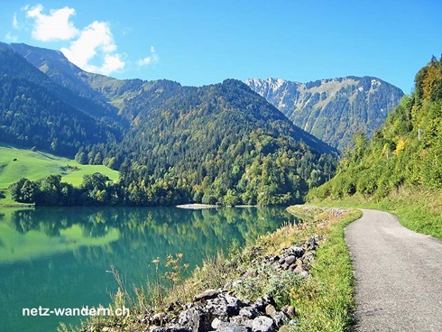
299-jaun-euschelpass-schwarzsee.html
299o1 ¦ Kanton: FR ¦ mittel ¦ T1

Jaun - Euschelpass - Schwarzsee
4h10 ¦ ↦ 12,3 km ¦ ↑ 740 m ¦ ↓ 705 m 299o1 ¦ Kanton: FR ¦ mittel ¦ T1
332-corbieres-broc-fabrique-corbieres.html
332o1 ¦ Kanton: FR ¦ mittel ¦ T1
Corbières - Broc Fabrique - Corbières
4h00 ¦ ↦ 13,4 km ¦ ↑ 520 m ¦ ↓ 520 m 332o1 ¦ Kanton: FR ¦ mittel ¦ T1
336-charmey-broc-gruyeres.html
336o1 ¦ Kanton: FR ¦ leicht ¦ T1

Charmey - Broc - Gruyères
3h20 ¦ ↦ 11,1 km ¦ ↑ 420 m ¦ ↓ 560 m 336o1 ¦ Kanton: FR ¦ leicht ¦ T1
350-murten-liebistorf-laupen.html
350o1 ¦ Kantone: BE, FR ¦ mittel ¦ T1
Murten - Liebistorf - Laupen
3h45 ¦ ↦ 14,7 km ¦ ↑ 280 m ¦ ↓ 240 m 350o1 ¦ Kantone: BE, FR ¦ mittel ¦ T1
361-payerne-granges-pres-marnand-lucens.html
361o1 ¦ Kantone: FR, VD ¦ mittel ¦ T1
Payerne - Granges près Marnand - Lucens
3h55 ¦ ↦ 16,2 km ¦ ↑ 80 m ¦ ↓ 40 m 361o1 ¦ Kantone: FR, VD ¦ mittel ¦ T1
366-fribourg-noreaz-payerne.html
366o1 ¦ Kantone: FR, VD ¦ schwer ¦ T1
Fribourg - Noréaz - Payerne
5h45 ¦ ↦ 22,7 km ¦ ↑ 400 m ¦ ↓ 575 m 366o1 ¦ Kantone: FR, VD ¦ schwer ¦ T1
369-schwarzsee-seeweid-schwarzsee.html
369o1 ¦ Kanton: FR ¦ leicht ¦ T1
Schwarzsee - Seeweid - Schwarzsee
1h00 ¦ ↦ 4,2 km ¦ ↑ 50 m ¦ ↓ 50 m 369o1 ¦ Kanton: FR ¦ leicht ¦ T1
370-schwarzsee-zollhaus-plaffeien.html
370o1 ¦ Kanton: FR ¦ leicht ¦ T1
Schwarzsee - Zollhaus - Plaffeien
2h30 ¦ ↦ 10,2 km ¦ ↑ 130 m ¦ ↓ 330 m 370o1 ¦ Kanton: FR ¦ leicht ¦ T1
375-bulle-broc-gruyeres.html
375o1 ¦ Kanton: FR ¦ leicht ¦ T1
Bulle - Broc - Gruyères
2h35 ¦ ↦ 9,8 km ¦ ↑ 220 m ¦ ↓ 245 m 375o1 ¦ Kanton: FR ¦ leicht ¦ T1
378-schwarzsee-la-balisaz-charmey.html
378o1 ¦ Kanton: FR ¦ mittel ¦ T1
Schwarzsee - La Balisa - Charmey
3h30 ¦ ↦ 12,4 km ¦ ↑ 440 m ¦ ↓ 610 m 378o1 ¦ Kanton: FR ¦ mittel ¦ T1
381-schwarzenburg-guggisberg-plaffeien.html
381o1 ¦ Kantone: BE, FR ¦ mittel ¦ T1
Schwarzenburg - Guggisberg - Plaffeien
4h20 ¦ ↦ 14,3 km ¦ ↑ 630 m ¦ ↓ 575 m 381o1 ¦ Kantone: BE, FR ¦ mittel ¦ T1
394-plaffeien-umbertsschweni-heitenried.html
394o1 ¦ Kanton: FR ¦ mittel ¦ T1
Plaffeien - Umbertsschweni - Heitenried
3h10 ¦ ↦ 12,4 km ¦ ↑ 285 m ¦ ↓ 370 m 394o1 ¦ Kanton: FR ¦ mittel ¦ T1
403-romont-curtilles-moudon.html
403o1 ¦ Kantone: FR, VD ¦ mittel ¦ T1
Romont - Curtilles - Moudon
3h35 ¦ ↦ 14,5 km ¦ ↑ 195 m ¦ ↓ 390 m 403o1 ¦ Kantone: FR, VD ¦ mittel ¦ T1
417o1-chatel-st-denis-ecoteaux-palezieux.html
417o1 ¦ Kantone: FR, VD ¦ leicht ¦ T1
Châtel-St-Denis - Ecoteaux - Palézieux
2h55 ¦ ↦ 11,8 km ¦ ↑ 195 m ¦ ↓ 335 m 417o1 ¦ Kantone: FR, VD ¦ leicht ¦ T1
419-plaffeien-plasselb-giffers.html
419o1 ¦ Kanton: FR ¦ leicht ¦ T1
Plaffeien - Plasselb - Giffers
2h45 ¦ ↦ 10,5 km ¦ ↑ 260 m ¦ ↓ 355 m 419o1 ¦ Kanton: FR ¦ leicht ¦ T1
488-plaffeien-rechthalten-st-ursen.html
488o1 ¦ Kanton: FR ¦ leicht ¦ T1
Plaffeien - Rechthalten - St. Ursen
3h00 ¦ ↦ 11,0 km ¦ ↑ 325 m ¦ ↓ 465 m 488o1 ¦ Kanton: FR ¦ leicht ¦ T1
letztes Update: 15.03.2024